Cameron Farrell - Unit 15
Tuesday, 10 November 2015
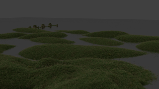
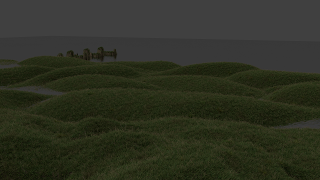
Revised Landform
The completed landform design is now much more geometric and futuristic. This concept will also fit into my building design as it shall act as a hollow shell containing the buildings underneath.
Monday, 2 November 2015
Precedents 01 - Landscape Urbanism
Landscape Urbanism is a fairly recent theory arguing the best way to produce a masterplan or design a city is to first design the landscape rather than the buildings. By first designing the landscape of the masterplan for the specific purpose of the site it will enable me to create a better overall scheme. I will use the article, 'Terra Fluxus' by James Corner as a reading material reference for this work. Following feedback I have realised my work (intended for the year 2100) fails in two primary ways:
- The design does not reflect or support the specific planned use of the site
- The style of the park design is outdated and does not fit into the future thinking scheme
I will now begin adjusting the design away from the curvy natural style towards a more geometric and futuristic landscape that fits with the advanced ideas of the site. In order to use this I will take inspiration from projects by Plasma Studio/Groundlab such as, 'Flowing Gardens, Xi’an International Horticultural Fair 2011'. I will however maintain my initial 'island like' elements of the design.
Sunday, 1 November 2015
Urban Design - Individual Masterplan 01
For the first 'Cross Critique' of the year I decided to once again focus primarily on the area to the West of the site (current industrial park), create a visual which clearly explains my intentions for transforming the park and also an overall masterplan which demonstrates consideration has been made for the rest of the site.

 The river will flood into the site throughout the day. This periodic flooding will be controlled by an underground system that will use this natural effect to harness energy and filter the water for use in the rest of the site.
 |
| Masterplan (Click To Expand) |
As Can be seen from the plan, I have revised the proposed landform for the West of the site, construsting a more complex series of islands. This landscape will act as a constructed hollow shell. I imagine the buildings to be constructed underneath this landform and to protrude though in certain places. Above the landform will be a web of pedestrian walkways interlinked with public realm spaces. People will have the option of using these walkways when the area is flooded or walking on the grass when the water levels descend. This local transport system will work in conjunction with the sites cable car infrastructure.

 The river will flood into the site throughout the day. This periodic flooding will be controlled by an underground system that will use this natural effect to harness energy and filter the water for use in the rest of the site.
Initially I have tried to the area as an extension of the natural park to the south. Dirt tracks, random tree placement, Japanese footbridges and a curvy marshland appearance bring a natural life to the site, working with the existing environment rather than opposing it. I am not yet sure if this plan will be suitable for the site as the plan is developed further, however as a starting point it fulfils the majority of my desires for the area.
Urban Design - Individual Strip Development
Following the submission of our group work we each decided to work on a small strip of the site to develop individually. As most of my work has involved the development of the industrial park to the west of the site I was assigned a strip in this area. As the primary driving point of this development is the transformation of this industrial park into a green park I decided that most of my focus initially needed to be dedicated to working on the new land-form of the site. once solidified (corresponding with group ideas of public transport and the future function of the site, building types etc) this will enable me to proceed more efficiently with the overall master plan.
Initially as a group we downloaded quite basic 5m spot heights/contour lines. In order to understand the site more accurately and make more judicious decisions I believed it necessary to first retrieve some more detailed mapping data of the site. Fortunately for myself, in September of this year, the Environment Agency has begun releasing all 11 terabytes of it's highly accurate LIDAR data for free public use under the Open Government License to be used for any purpose. By downloading The ASC tiles for our site and using the grasshopper algorithm plug-in for Rhino, I was able to use the data to create a very accurate 3D surface of the overall site. This surface has provided much more information than the previous group contour lines and has been very useful especially with regards to issues such as flood prediction.
By selecting vertices within the surface I was able to manipulate the land-form to create the effect i desired. A new landscape continuing on from Maryon park that allows the water to penetrate the site from multiple directions. The inclusion of more flat level areas and hidden valleys also allows for possible agricultural areas and hidden building entrances. The image below is a combination of each person's individual strip, followed by a close of of my strip with a particular focus on new contour lines.
 |
| LIDAR Map Created From ASC Data |
 |
| Flood Prediction Using Horiztonal Plane |
 |
| Group Masterplan |
 |
| Revised Topographic Map |
Monday, 19 October 2015
Urban Design - Continued Group Development 05 (Energy Harvesting)
With the local plan finalised and the landform set in a way that allows for our desired movement of water I decided to start planning out in greater detail a new concept for harvesting energy from tidal river flow.
Urban Design - Continued Group Development 04 (Residential Strategy)
Continuing with the idea of a collaborative democracy within this experimental self-sustaining society we decided to implement a grid structure throughout the east side of the site. This structure, whether physical or metaphorical in nature would allow people to build temporary housing within the structure without traditional foundations. The grid would break apart in the paths of the cable cars allowing the cars to stop at any moment during the ride and allow people to simply step off onto an elevated walkway. In addition to this, we have decided to convert an existing chimney within the site into a 'drone parking facility'. Drones similar to what we have today will have the ability to delivery food etc to the residents and workers of this new society and then charge themselves on this chimney, waiting to be called into service.
Urban Design - Continued Group Development 03 (Transport)
Finalising the transport strategy was important in order to progress further and create a more detailed design. We agreed on utilising a cable car system throughout the site, therefore it was important to decide on the locations for the cable car towers (to be used as drop off points).
We based our decisions for locations on optimising views across the river, allowing enough stations spread evenly through the site (for ease of access) and to allow for future expansion/development. In addition to this we introduced a number of elevated pedestrian walkways and public realm spaces (around the towers) that would work in conjunction with the new landform and flooding strategy.
Subscribe to:
Comments (Atom)


